首页 >标准规范

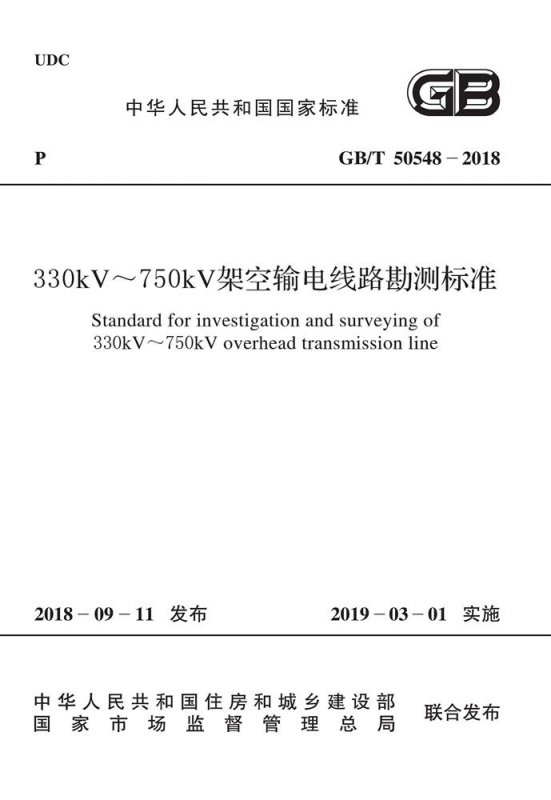
330kV~750kV架空输电线路勘测标准

Standard for investigation and surveying of 330kV~750kV overhead transmission line

会员免费阅读,去 购买

  • 标准信息
  • 中文目录
  • 英文目录
  • 公告
收起

标准信息

  • 【主编部门】
    中国电力企业联合会
  • 【批准部门】

    中华人民共和国住房和城乡建设部

  • 【发布单位】

    中华人民共和国住房和城乡建设部;国家市场监督管理总局

  • 【主编单位】

    中国电力工程顾问集团中南电力设计院有限公司

  • 【参编单位】

    电力规划设计总院;中国电力工程顾问集团东北电力设计院有限公司;中国电力工程顾问集团西北电力设计院有限公司;中国电力工程顾问集团华北电力设计院有限公司;中国电力工程顾问集团华东电力设计院有限公司;中国电力工程顾问集团西南电力设计院有限公司;北京洛斯达科技发展有限公司;广东省电力设计研究院有限公司;山西省电力勘测设计院有限公司;山东电力工程咨询院有限公司;四川电力设计咨询有限责任公司

  • 【主要起草人】

    程正逢;石克勤;艾传井;刘德平;邓南文;(以下按姓氏笔画先后排序);王占华;王起峰;代宏柏;朱亚光;朱宏波;刘志伟;李慕清;连捷;吴刚;张晓健;张健;陈功;陈志杰;邵峰;金西平;赵永胜;胡吉伦;胡昌盛;段文辉;饶贞祥;姚鹏;秦朝国;聂文波;贾玉明;贾建勋;徐炎兵;郭新春;谭光杰;燕慧晓

  • 【主要审查人】

    刘厚健;戴有信;陈亚明;姚麒麟;余小奎;李卫林;孟庆辉;曹玉明;张性慧;梁水林;曾德培;廖爱平;单龙学;景钦刚;胡新丽

收起

中文目录

  • 中华人民共和国住房和城乡建设部公告

  • 前  言

  • 1 总  则

  • 2 术语和缩略语

    • 2.1 术  语

    • 2.2 缩 略 语

  • 3 基本规定

    • 3.1 测  量

    • 3.2 岩土工程勘察

    • 3.3 工程水文勘测

    • 3.4 工程气象勘测

  • 4 可行性研究阶段测量

    • 4.1 一般规定

    • 4.2 内业测量

    • 4.3 外业测量

    • 4.4 测量成果

  • 5 初步设计阶段测量

    • 5.1 一般规定

    • 5.2 内业测量

    • 5.3 外业测量

    • 5.4 测量成果

  • 6 施工图设计阶段测量

    • 6.1 一般规定

    • 6.2 基础控制测量

    • 6.3 辅助路径优化

    • 6.4 落实路径测量

    • 6.5 平面与高程联系测量

    • 6.6 交叉跨越测量

    • 6.7 平面及断面测量

    • 6.8 定位与检验测量

    • 6.9 塔基断面测量

    • 6.10 测量成果

  • 7 专项测量

    • 7.1 塔位坐标联测及转换

    • 7.2 房屋分布图调查测量

    • 7.3 林木分布调查测量

    • 7.4 塔位地形图测量

    • 7.5 接地极极址测量

    • 7.6 土石方测量

    • 7.7 水文测量

    • 7.8 运行维护测量

    • 7.9 安全监测

  • 8 改造测量

    • 8.1 一般规定

    • 8.2 风灾改造测量

    • 8.3 冰灾改造测量

    • 8.4 导线温升增容改造测量

  • 9 卫星遥感测量

    • 9.1 一般规定

    • 9.2 影像数据获取与预处理

    • 9.3 像片控制测量

    • 9.4 空中三角测量

    • 9.5 DEM建立

    • 9.6 DOM制作

  • 10 机载激光雷达测量

    • 10.1 一般规定

    • 10.2 数据获取

    • 10.3 数据预处理

    • 10.4 DSM与DEM制作

    • 10.5 内业测绘

  • 11 卫星定位测量

    • 11.1 一般规定

    • 11.2 静态卫星定位测量

    • 11.3 动态卫星定位测量

  • 12 地理信息系统的建立与维护

    • 12.1 一般规定

    • 12.2 地理信息系统的建立

    • 12.3 地理信息系统的维护

  • 13 可行性研究阶段岩土工程勘察

  • 14 初步设计阶段岩土工程勘察

  • 15 施工图设计阶段岩土工程勘察

    • 15.1 一般规定

    • 15.2 平原河谷区勘察

    • 15.3 山地丘陵区勘察

    • 15.4 深切峡谷区勘察

    • 15.5 戈壁沙漠区勘察

    • 15.6 勘察成果

  • 16 岩土工程勘察方法

    • 16.1 工程地质调查

    • 16.2 遥感解译

    • 16.3 工程物探

    • 16.4 勘探与测试

  • 17 特殊性岩土分布区岩土工程勘察

    • 17.1 湿陷性黄土

    • 17.2 多年冻土

    • 17.3 软  土

    • 17.4 膨胀岩土

    • 17.5 红 黏 土

    • 17.6 填  土

    • 17.7 风化岩与残积土

    • 17.8 盐 渍 土

    • 17.9 混 合 土

  • 18 特殊地质条件岩土工程勘察

    • 18.1 岩溶与洞穴

    • 18.2 滑  坡

    • 18.3 崩塌与倒石堆

    • 18.4 冲  沟

    • 18.5 泥 石 流

    • 18.6 地震液化及震陷

    • 18.7 采 空 区

  • 19 原体试验

  • 20 基坑检验

  • 21 可行性研究阶段工程水文勘测

    • 21.1 一般规定

    • 21.2 勘测内容深度与技术要求

    • 21.3 勘测成果

  • 22 初步设计阶段工程水文勘测

    • 22.1 一般规定

    • 22.2 勘测内容深度与技术要求

    • 22.3 勘测成果

  • 23 施工图设计阶段工程水文勘测

    • 23.1 一般规定

    • 23.2 勘测内容深度与技术要求

    • 23.3 勘测成果

  • 24 水文查勘

    • 24.1 一般规定

    • 24.2 人类活动影响调查

    • 24.3 洪涝调查

    • 24.4 河床、海床演变调查

    • 24.5 冰情及河流漂浮物调查

    • 24.6 岩溶地区水文调查

    • 24.7 水文测验

  • 25 水文分析计算

    • 25.1 一般规定

    • 25.2 天然河流设计洪水

    • 25.3 水库上、下游设计洪水

    • 25.4 溃堤、溃坝洪水

    • 25.5 冰情洪水

    • 25.6 特殊地区洪水

    • 25.7 设计洪水位

    • 25.8 设计流速

    • 25.9 滨海、河口水文分析计算

  • 26 河床、海床演变分析

    • 26.1 一般规定

    • 26.2 河床演变分析

    • 26.3 海床演变分析

    • 26.4 冲刷分析计算

  • 27 可行性研究阶段工程气象勘测

    • 27.1 一般规定

    • 27.2 勘测内容深度与技术要求

    • 27.3 勘测成果

  • 28 初步设计阶段工程气象勘测

    • 28.1 一般规定

    • 28.2 勘测内容深度与技术要求

    • 28.3 勘测成果

  • 29 施工图设计阶段工程气象勘测

    • 29.1 一般规定

    • 29.2 勘测内容深度与技术要求

    • 29.3 勘测成果

  • 30 气象查勘

    • 30.1 一般规定

    • 30.2 大风调查

    • 30.3 覆冰调查

    • 30.4 主导风向调查

    • 30.5 专用气象站与观测

  • 31 气象分析计算

    • 31.1 一般规定

    • 31.2 设计风速

    • 31.3 设计冰厚

  • 附录A 拥挤地段平面图样图

  • 附录B 通信线影响相对位置图样图

  • 附录C 变电站或发电厂进出线平面图样图

  • 附录D 测量标桩规格及埋设尺寸及点之记

  • 附录E 平行接近线路相对位置平面图样图

  • 附录F 交叉跨越分图样图

  • 附录G 输电线路平断面图样图

  • 附录H 平面图、断面图符号表

  • 附录J 塔基断面图样图

  • 附录K 房屋分布图样图

  • 附录L 林木分布图样图

  • 附录M 塔位地形图样图

  • 附录N 极环纵断面图样图

  • 附录P 塔基水文条件一览表

  • 附录Q 覆冰种类判别条件一览表

  • 附录R 风速次时换算公式系数

  • 本标准用词说明

  • 引用标准名录

收起

英文目录

  • 1 General provisions

  • 2 Terms and abbreviation

    • 2.1 Terms

    • 2.2 Abbreviation

  • 3 Basic requirements

    • 3.1 Survey

    • 3.2 Geotechnical investigation

    • 3.3 Engineering hydrological investigation and surveying

    • 3.4 Engineering meteorological investigation and surveying

  • 4 Survey of feasibility study stage

    • 4.1 General requirements

    • 4.2 Office work

    • 4.3 Field work

    • 4.4 Surveying result

  • 5 Survey of preliminary design stage

    • 5.1 General requirements

    • 5.2 Office work

    • 5.3 Field work

    • 5.4 Surveying result

  • 6 Survey of working drawing design stage

    • 6.1 General requirements

    • 6.2 Basic control survey

    • 6.3 Assistant route optimization

    • 6.4 Route location survey

    • 6.5 Plane and elevation connection survey

    • 6.6 Cross survey

    • 6.7 Plane and cross section survey

    • 6.8 Positioning and testing survey

    • 6.9 Section survey of tower foundation

    • 6.10 Surveying result

  • 7 Special survey

    • 7.1 Tower coordinate survey and transformation

    • 7.2 House distribution survey

    • 7.3 Forest distribution survey

    • 7.4 Topographic survey of tower position

    • 7.5 Ground electrode site survey

    • 7.6 Earthwork volume survey

    • 7.7 Hydrological survey

    • 7.8 Maintenance survey for operation phase

    • 7.9 Safety monitoring

  • 8 Electric power line reconstruction survey

    • 8.1 General requirements

    • 8.2 Windstorm disaster reconstruction survey

    • 8.3 Ice disaster reconstruction survey

    • 8.4 Temperature rise increase capacity reconstruction survey

  • 9 Satellite remote sensing survey

    • 9.1 General requirements

    • 9.2 Photograph control survey and photograph annotation

    • 9.3 Aerial triangulation

    • 9.4 DEM creation

    • 9.5 DOM creation

    • 9.6 Indoor digital mapping and test survey and rectification

  • 10 Airborn lidar surveying

    • 10.1 General requirements

    • 10.2 Data acquisition

    • 10.3 Data preprocessing

    • 10.4 DSM and DEM creation

    • 10.5 Digital mapping

  • 11 Satellite positioning survey

    • 11.1 General requirements

    • 11.2 Static satellite positioning survey

    • 11.3 Dynamic satellite positioning survey

  • 12 Establishment and maintenance of geographic information system

    • 12.1 General requirements

    • 12.2 Establishment of geographic information system

    • 12.3 Maintenance of geographic information system

  • 13 Geotechnical investigation of feasibility study stage

  • 14 Geotechnical investigation of preliminary design stage

  • 15 Geotechnical investigation of working drawing design stage

    • 15.1 General requirements

    • 15.2 Investigation for plain and river valley

    • 15.3 Investigation for mountain and hill

    • 15.4 Investigation for deep canyon

    • 15.5 Investigation for desert

    • 15.6 Investigation results

  • 16 Method of geotechnical investigation

    • 16.1 Engineering geological survey

    • 16.2 Remote sensing

    • 16.3 Geophysical exploration

    • 16.4 Exploration and testing

  • 17 Geotechnical investigation for special lithology

    • 17.1 Collapsible loess

    • 17.2 Frozen soil

    • 17.3 Soft soil

    • 17.4 Expansive soil and rock

    • 17.5 Red clay

    • 17.6 Filled ground

    • 17.7 Weathered rock and residual soil

    • 17.8 Saline soil

    • 17.9 Mixed soil

  • 18 Geotechnical investigation for special geologic condition

    • 18.1 Karst and cave

    • 18.2 Landslide

    • 18.3 Avalanche and collapse heap

    • 18.4 Gully

    • 18.5 Debris flow

    • 18.6 Seismic liquefaction and subsidence

    • 18.7 Mined out space

  • 19 Prototype test

  • 20 Foundaion pit proving

  • 21 Engineering hydrological investigation and surveying of feasibility study stage

    • 21.1 General requirements

    • 21.2 Contents and technical requirements

    • 21.3 Outcome

  • 22 Engineering hydrological investigation and surveying of preliminary design stage

    • 22.1 General requirements

    • 22.2 Contents and technical requirements

    • 22.3 Outcome

  • 23 Engineering hydrological investigation and surveying of working drawing design stage

    • 23.1 General requirements

    • 23.2 Contents and technical requirements

    • 23.3 Outcome

  • 24 Hydrological investigation and surveying

    • 24.1 General requirements

    • 24.2 Impact of human activity

    • 24.3 Flood and waterlogging

    • 24.4 Riverbed evolution

    • 24.5 Ice and river float

    • 24.6 Specific areas

    • 24.7 Hydrological survey

  • 25 Hydrological analysis and calculation

    • 25.1 General requirements

    • 25.2 Natural river design flood

    • 25.3 Design flood about the upper stream and downstream of the reservoir

    • 25.4 The dike-breach and dam-break design flood

    • 25.5 Ice flood

    • 25.6 Special area design flood

    • 25.7 The design flood stage

    • 25.8 The design flow rate

    • 25.9 The hydrological analysis about the coastal and river mouth area

  • 26 The evolution analysis of the river and sea bed

    • 26.1 General requirements

    • 26.2 Analysis of the evolution of the river bed

    • 26.3 Analysis of the evolution of the seabed

    • 26.4 Scour analysis calculation

  • 27 Engineering meteorological investigation and surveying of feasibility study stage

    • 27.1 General requirements

    • 27.2 Content and technical requirements

    • 27.3 Outcome

  • 28 Engineering meteorological investigation and surveying of preliminary design stage

    • 28.1 General requirements

    • 28.2 Content and technical requirements

    • 28.3 Outcome

  • 29 Engineering meteorological investigation and surveying of working drawing design stage

    • 29.1 General requirements

    • 29.2 Content and technical requirements

    • 29.3 Outcome

  • 30 Meteorology survey

    • 30.1 General requirements

    • 30.2 Strong wind

    • 30.3 Wire ice covering

    • 30.4 Predominant wind direction

    • 30.5 Meteorology special-purpose station and observation

  • 31 Meteorological analysis and calculation

    • 31.1 General requirements

    • 31.2 Design wind speed

    • 31.3 Design wire ice covering

  • Appendix A Planimetic map in crowded area

  • Appendix B Relative location map of communication lines risk influence

  • Appendix C Plan legend for substation or power plant lines in and out

  • Appendix D Survey stake standard and embedding size

  • Appendix E Relative position plan samples of parallel proximity line

  • Appendix F Intersection and crossing plan

  • Appendix G Plan and section samples of transmission line

  • Appendix H Symbol list of plane metric and section plan

  • Appendix J Tower foundation section plan

  • Appendix K House distribution map

  • Appendix L Forest distribution map

  • Appendix M Tower position topographic map

  • Appendix N Electrode loop profile diagram

  • Appendix P The schedule of hydrological condition about pole tower

  • Appendix Q The calculation about the design wind speed

  • Appendix R The calculation about the design wire ice covering thickness

  • Explanation of wording in this standard

  • List of quoted standards

收起

公告

中华人民共和国住房和城乡建设部公告

4-40-00
2018年 第217号
住房城乡建设部关于发布国家标准《330kV~750kV架空输电线路勘测标准》的公告
现批准《330kV~750kV架空输电线路勘测标准》为国家标准,编号为GB/T 50548—2018,自2019年3月1日起实施。原《330kV~750kV架空输电线路勘测规范》(GB 50548—2010)同时废止。
本标准在住房城乡建设部门户网站(www.mohurd.gov.cn)公开,并由住房城乡建设部标准定额研究所组织中国计划出版社出版发行。
中华人民共和国住房和城乡建设部
2018年9月11日
收起

本书术语

术语 英文名称 术语 英文名称
基础控制测量 basic control survey 落实路径测量 route location survey
直线桩 the stake of straight line 塔位桩 stake of tower site
中心断面 central section 边线断面 sideline section
风偏点 wind slanting point 交叉跨越点 cross point of two lines
横断面 cross section 树高线 height line of trees

确定