首页 >标准规范

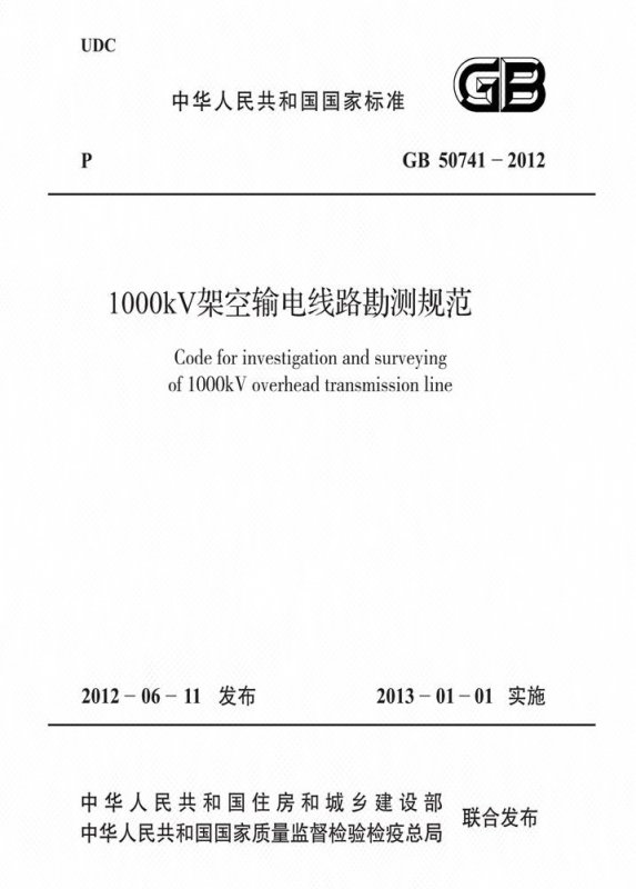
1000kV架空输电线路勘测规范

Code for investigation and surveying of 1000kV overhead transmission line

会员免费阅读,去 购买

  • 标准信息
  • 中文目录
  • 英文目录
  • 公告
收起

标准信息

  • 【主编部门】
    中国电力企业联合会
  • 【批准部门】

    中华人民共和国住房和城乡建设部

  • 【发布单位】

    中华人民共和国住房和城乡建设部;中华人民共和国国家质量监督检验检疫总局

  • 【主编单位】

    中国电力工程顾问集团公司

  • 【参编单位】

    国家电网公司;中国电力工程顾问集团东北电力设计院;中国电力工程顾问集团华东电力设计院;中国电力工程顾问集团中南电力设计院;中国电力工程顾问集团西北电力设计院;中国电力工程顾问集团西南电力设计院;中国电力工程顾问集团华北电力设计院工程有限公司;北京洛斯达数字遥感技术有限公司

  • 【主要起草人】

    于刚;梁政平;孙昕;王中平;王圣祖;丁扬;朱京兴;袁骏;陆武萍;戴有信;徐健;余凤先;姚鹏;刘厚健;曹玉明;齐迪;熊海星;吕铎;秦学林;邓南文;殷金华;张良忠;陈亚明;李彦利;桂红华;曹永生

  • 【主要审查人】

    曹卫东;张国杰;饶贞祥;郑怀清;刘小青;尹镇龙;蔡上;段松涛;胡红春;王曦辰;邓加娜;姚麒麟;刘颖;欧子春;李卫林;姜典;代宏柏;王基文;卢晓东;程小久;梁水林;王骢;吴军帅;汪岩松;谭国铨;李文林;周美玉;贾剑;胡长权

收起

中文目录

  • 中华人民共和国住房和城乡建设部公告

  • 前  言

  • 1 总  则

  • 2 术语和符号

    • 2.1 术  语

    • 2.2 符  号

  • 3 基本规定

    • 3.1 测  量

    • 3.2 岩土工程勘察

    • 3.3 水文勘测

    • 3.4 气象勘测

  • 4 可行性研究阶段测量

    • 4.1 一般规定

    • 4.2 室内工作

    • 4.3 现场工作和测量成果

  • 5 初步设计阶段测量

    • 5.1 一般规定

    • 5.2 航空摄影

    • 5.3 控制测量

    • 5.4 路径走廊调绘

    • 5.5 空中三角测量

    • 5.6 建立路径三维数字模型

    • 5.7 室内选择路径方案

    • 5.8 现场工作和测量成果

  • 6 施工图设计阶段测量

    • 6.1 一般规定

    • 6.2 现场落实路径

    • 6.3 定线测量、桩间距离测量、高差测量

    • 6.4 联系测量

    • 6.5 平面及断面测量

    • 6.6 交叉跨越测量

    • 6.7 定位测量

    • 6.8 塔基断面及塔位地形测量

    • 6.9 房屋分布图测量

    • 6.10 塔位坐标测量

    • 6.11 测量成果

  • 7 可行性研究阶段岩土工程勘察

    • 7.1 勘察技术要求

    • 7.2 勘察成果

  • 8 初步设计阶段岩土工程勘察

    • 8.1 勘察技术要求

    • 8.2 勘察成果

  • 9 施工图设计阶段岩土工程勘察

    • 9.1 一般规定

    • 9.2 平原河谷地区勘察

    • 9.3 山地丘陵地区勘察

    • 9.4 戈壁沙漠地区勘察

    • 9.5 勘察成果

  • 10 特殊性岩土

    • 10.1 湿陷性土

    • 10.2 软  土

    • 10.3 膨 胀 土

    • 10.4 红 黏 土

    • 10.5 填  土

    • 10.6 冻  土

    • 10.7 风化岩与残积土

    • 10.8 盐渍岩土

    • 10.9 混 合 土

  • 11 不良地质作用和地质灾害

    • 11.1 岩  溶

    • 11.2 滑  坡

    • 11.3 崩  塌

    • 11.4 泥 石 流

    • 11.5 采 空 区

    • 11.6 活动断裂、场地和地基的地震效应

  • 12 地 下 水

  • 13 岩土工程勘察方法

    • 13.1 工程地质调查与测绘

    • 13.2 坑探和钻探

    • 13.3 原位测试

    • 13.4 物  探

    • 13.5 遥  感

  • 14 原位试验

  • 15 现场检验

  • 16 可行性研究阶段水文勘测

  • 17 初步设计阶段水文勘测

  • 18 施工图设计阶段水文勘测

  • 19 水文调查

    • 19.1 一般规定

    • 19.2 人类活动影响调查

    • 19.3 洪水调查

    • 19.4 河(海)床演变调查

    • 19.5 冰情及河道漂浮物调查

    • 19.6 水文测验

    • 19.7 特殊地区调查

  • 20 设计洪水分析计算

    • 20.1 一般规定

    • 20.2 天然河流设计洪水

    • 20.3 水库上、下游设计洪水

    • 20.4 特殊地区洪水

    • 20.5 设计洪水要素

    • 20.6 人类活动对洪水的影响

  • 21 河(海)床演变分析

    • 21.1 一般规定

    • 21.2 河床演变

    • 21.3 海床演变

    • 21.4 人类活动对岸滩稳定性的影响

    • 21.5 塔基冲刷计算

  • 22 可行性研究阶段气象勘测

    • 22.1 勘测内容深度与技术要求

    • 22.2 勘测成果

  • 23 初步设计阶段气象勘测

    • 23.1 勘测内容深度与技术要求

    • 23.2 勘测成果

  • 24 施工图设计阶段气象勘测

    • 24.1 勘测内容深度与技术要求

    • 24.2 勘测成果

  • 25 气象调查

    • 25.1 一般规定

    • 25.2 大风调查

    • 25.3 覆冰调查

    • 25.4 气象专用站观测

  • 附录A 测量标桩规格及埋设尺寸

  • 附录B 输电线路平断面图样图

  • 附录C 平面图、断面图符号表

    • C.1 一般规定

    • C.2 图形符号

  • 附录D 塔基断面图样图

  • 附录E 塔位岩土工程条件综合成果表

  • 附录F 河流稳定性分类表

  • 附录G 塔基局部冲刷计算

  • 附录H 设计风速分析计算

  • 附录J 设计覆冰厚度分析计算

  • 本规范用词说明

  • 引用标准名录

收起

英文目录

  • 1 General provisions

  • 2 Terms and symbols

    • 2.1 Terms

    • 2.2 Symbols

  • 3 Basic requirement

    • 3.1 Survey

    • 3.2 Geotechnical investigations

    • 3.3 Hydrological survey

    • 3.4 Meteorological survey

  • 4 Survey at feasibility study stage

    • 4.1 General requirement

    • 4.2 Office work

    • 4.3 Field work and survey results

  • 5 Survey at preliminary design stage

    • 5.1 General requirement

    • 5.2 Aerial photography

    • 5.3 Control survey

    • 5.4 Investigation and annotation of route zone

    • 5.5 Aero triangulation

    • 5.6 Establishment of 3Ddigital route model

    • 5.7 Route plan selection indoor

    • 5.8 Field work and survey results

  • 6 Survey at detail design stage

    • 6.1 General requirement

    • 6.2 Fulfillment of route selection outdoor

    • 6.3 Survey of straight line location,distance between two stakes and difference of elevation

    • 6.4 Connection survey

    • 6.5 Plane and section survey

    • 6.6 Cross survey

    • 6.7 Tower spotting survey

    • 6.8 Section survey of tower foundation and topographic survey of tower position

    • 6.9 House distribution survey

    • 6.10 Tower coordinates survey

    • 6.11 Survey results

  • 7 Geotechnical investigations at feasibility study stage

    • 7.1 Technical requirements of investigations

    • 7.2 Investigations results

  • 8 Geotechnical investigations at preliminary design stage

    • 8.1 Technical requirements of investigations

    • 8.2 Investigations results

  • 9 Geotechnical investigations at detail design stage

    • 9.1 General requirement

    • 9.2 Investigations at plain area

    • 9.3 Investigations at mountainous region

    • 9.4 Investigations at desert area

    • 9.5 Investigations results

  • 10 Special rock and soil

    • 10.1 Collapsible soil

    • 10.2 Soft clay

    • 10.3 Expansive rock and soil

    • 10.4 Laterite

    • 10.5 Fill

    • 10.6 Frozen soil

    • 10.7 Weathered rock and residual soil

    • 10.8 Saline soil

    • 10.9 Mixed soil

  • 11 Adverse geologic action and geologic disaster

    • 11.1 Karst

    • 11.2 Landslide

    • 11.3 Avalanche

    • 11.4 Debris flow

    • 11.5 Goaf

    • 11.6 Seismic effect of site and subgrade

  • 12 Ground water

  • 13 Methods of geotechnical investigations

    • 13.1 Engineering geological mapping and investigation

    • 13.2 Exploring pit and drill

    • 13.3 In-situ tests

    • 13.4 Geophysical exploring

    • 13.5 Remote sensing

  • 14 In-situ tests

  • 15 In-situ inspection

  • 16 Hydrological survey in feasibility study stage

  • 17 Hydrological survey in preliminary design stage

  • 18 Hydrological survey in detail design stage

  • 19 Hydrological investigation

    • 19.1 General requirement

    • 19.2 Human impact investigation

    • 19.3 Flood investigation

    • 19.4 Fluvial processes investigation

    • 19.5 Ice-regime and floats investigation

    • 19.6 Hydrometry

    • 19.7 Hydrological investigation in special area

  • 20 Design flood computation

    • 20.1 General requirement

    • 20.2 Design flood of natural river

    • 20.3 Design flood at upstream/downstream of reservoir

    • 20.4 Design flood of special area

    • 20.5 Design flood level and velocity

    • 20.6 Flood impact by human activities

  • 21 Analysis of fluvial process and seabed evolution

    • 21.1 General requirement

    • 21.2 Fluvial process

    • 21.3 Seabed evolution

    • 21.4 Stability impact by human activities

    • 21.5 Calculation of foundation scour

  • 22 Meteorological survey in feasibility study stage

    • 22.1 Content and technical requirements

    • 22.2 Survey results

  • 23 Meteorological survey in preliminary design stage

    • 23.1 Content and technical requirements

    • 23.2 Survey results

  • 24 Meteorological survey in detail design stage

    • 24.1 Content and technical requirements

    • 24.2 Survey results

  • 25 Meteorological investigation

    • 25.1 General requirement

    • 25.2 Strong wind investigation

    • 25.3 Line icing investigation

    • 25.4 Observation by special meteorological station

  • Appendix A Specification and size of inbuilt survey stakes

  • Appendix B Planar and sectional samples of transmission line

  • Appendix C Symbol list of planar and sectional plan

  • Appendix D Tower foundation sectional plan

  • Appendix E Results table for geotechnical investigation of towers

  • Appendix F Classification of river stability

  • Appendix G Calculation of partial scour of foundation

  • Appendix H Calculation of designed wind velocity

  • Appendix J Calculation of designed ice thickness

  • Explanation of wording in this code

  • List of quoted standards

收起

公告

中华人民共和国住房和城乡建设部公告

4-4 0-0 0
第1426号
关于发布国家标准《1000kV架空输电线路勘测规范》的公告
现批准《1000kV架空输电线路勘测规范》为国家标准,编号为GB 50741—2012,自2013年1月1日起实施。其中,第11.1.111.2.111.4.1条为强制性条文,必须严格执行。
本规范由我部标准定额研究所组织中国计划出版社出版发行。
中华人民共和国住房和城乡建设部
二○一二年六月十一日
收起

本书术语

术语 英文名称 术语 英文名称
定线测量 straight line location survey 定位测量 location survey
现场检验 in-situ inspection 洪痕 flood marks
设计洪水 design flood 溃坝洪水 dam-break flood
河床演变 fluvial process 设计风速 design wind speed
导线覆冰 wire ice covering 标准冰厚 standard ice thickness

确定