点击右上角 ··· 选择
【发送给好友】或【分享到朋友圈】
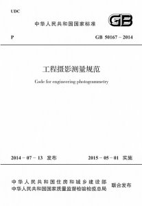
GB 50167-2014 工程摄影测量规范 - 工标库

GB 50167-2014 工程摄影测量规范 现行

发布日期:2014-07-13

实施日期:2015-05-01

替代以下标准: GB 50167-92  

  • 标准信息
  • 中文目录
  • 英文目录
  • 公告

中文目录

  • 中华人民共和国住房和城乡建设部公告

  • 前言

  • 1 总则

  • 2 术语、代号和符号

    • 2.1 术语

    • 2.2 代号

    • 2.3 符号

  • 3 基本规定

    • 3.1 成果类型

    • 3.2 坐标系统

    • 3.3 技术要求

    • 3.4 成果整理

    • 3.5 成果检查验收与提交

  • 4 航空摄影测量

    • 4.1 一般规定

    • 4.2 航摄影像获取

    • 4.3 像片控制测量

    • 4.4 像片调绘

    • 4.5 空中三角测量

    • 4.6 数字线划图测绘

    • 4.7 工业厂区细部坐标点的坐标量测

    • 4.8 数字高程模型

    • 4.9 数字正射影像图

    • 4.10 补充测量

    • 4.11 资料整理与归档

  • 5 机载激光雷达测量

    • 5.1 一般规定

    • 5.2 数据获取

    • 5.3 数据处理

    • 5.4 资料整理与归档

  • 6 地面激光扫描测量

    • 6.1 一般规定

    • 6.2 数据获取

    • 6.3 数据处理

    • 6.4 成果制作

    • 6.5 资料整理与归档

  • 7 近景摄影测量

    • 7.1 一般规定

    • 7.2 物方控制

    • 7.3 数据获取

    • 7.4 数据处理

    • 7.5 成果制作

    • 7.6 资料整理与归档

  • 8 卫星遥感测量

    • 8.1 一般规定

    • 8.2 影像获取与预处理

    • 8.3 数字正射影像图

    • 8.4 数字线划图测绘

    • 8.5 影像解译

    • 8.6 资料整理与归档

  • 附录A 低空数字摄影飞行器及数字相机要求

  • 附录B 数字航摄仪检校场布设

  • 附录C 地面标志的形状和尺寸

  • 附录D 像片刺点控制片的整饰格式

  • 附录E 像片调绘的相关规定

  • 附录F 机载激光雷达检校场布设

  • 附录G 近景摄影测量人工标志的形状

  • 附录H 正直、交向摄影的精度估算公式

  • 本规范用词说明

  • 引用标准名录

英文目录

  • 1 General provisions

  • 2 Terms,codes and symbols

    • 2.1 Terms

    • 2.2 Codes

    • 2.3 Symbols

  • 3 Basic requirement

    • 3.1 Type of result

    • 3.2 Coordinate system

    • 3.3 Technical requirement

    • 3.4 Results arrangement

    • 3.5 Results acceptance and submitting

  • 4 Aerial photogrammetry

    • 4.1 General requirement

    • 4.2 Aerial photography

    • 4.3 Control survey of photograph

    • 4.4 Annotation of photograph

    • 4.5 Aerotriangulation

    • 4.6 Digital line graphic

    • 4.7 Coordinate measurement of detail point of industrial area

    • 4.8 Digital elevation model

    • 4.9 Digital orthophoto map

    • 4.10 Extra-survey

    • 4.11 Results arrangement and archiving

  • 5 Airborne LIDAR

    • 5.1 General requirement

    • 5.2 Data capture

    • 5.3 Data processing

    • 5.4 Results arrangement and archiving

  • 6 Terrestrial laser scanning survey

    • 6.1 General requirement

    • 6.2 Data capture

    • 6.3 Data processing

    • 6.4 Product making

    • 6.5 Results arrangement and archiving

  • 7 Close-range photogrammetry

    • 7.1 General requirement

    • 7.2 Object control survey

    • 7.3 Data capture

    • 7.4 Data processing

    • 7.5 Product making

    • 7.6 Results arrangement and archiving

  • 8 Satellite remote sensing

    • 8.1 General requirement

    • 8.2 Image of remote sensing satellite and image preprocessing

    • 8.3 Digital orthophoto map

    • 8.4 Digital line graphic

    • 8.5 Image interpretation

    • 8.6 Results arrangement and archiving

  • Appendix A Technical requirement of low-altitude photography flight vehicle and photogrammetric digital camera

  • Appendix B Layout of calibrating field for aerial photographic digital camera

  • Appendix C Shape with size of ground mark for photogrammetry

  • Appendix D Decoration format of pierced photography

  • Appendix E Relevant regulations of annotation

  • Appendix F Layout of calibrating field for airborne LIDAR

  • Appendix G Shape of artificial mark for close-range photogrammetry

  • Appendix H Formula of precision estimation of normal case and convergent photography

  • Explanation of wording in this code

  • List of quoted standards

中华人民共和国住房和城乡建设部公告

4-4 0-0 0
第483号
住房城乡建设部关于发布国家标准《工程摄影测量规范》的公告
现批准《工程摄影测量规范》为国家标准,编号为GB 50167-2014,自2015年5月1日起实施。其中,第4.1.3条为强制性条文,必须严格执行。原国家标准《工程摄影测量规范》GB 50167-92同时废止。
本规范由我部标准定额研究所组织中国计划出版社出版发行。
中华人民共和国住房和城乡建设部
2014年7月13日

本书术语

术语 英文名称
工程摄影测量 engineering photogrammetry
细部坐标点 detail point with coordinate
基高比 base-height ratio
摄站 exposure station
机载激光雷达测量 airborne LIDAR
点云 point cloud
点云密度 density of point cloud
点云分类 classification of point cloud
影像地形图 orthophoto topographic map
专题图 thematic plan

首页 |关于我们 |联系我们 |帮助中心

主办:中国计划出版社 版权所有 侵权必究 合作共建单位:中国工程建设标准化协会 京ICP备05021380号-5
新建收藏夹

选择收藏夹

收藏夹名称