点击右上角 ··· 选择
【发送给好友】或【分享到朋友圈】
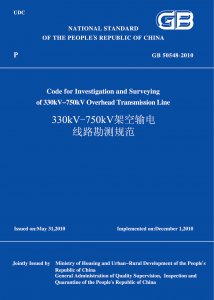
GB 50548-2010 330kV-750kV架空输电线路勘测规范 - 工标库

GB 50548-2010 330kV-750kV架空输电线路勘测规范 废止

发布日期:2010-05-31

实施日期:2010-12-01

被以下标准替代: GB/T 50548-2018  

废止日期:2019-03-01

  • 标准信息
  • 中文目录
  • 英文目录

中文目录

  • Announcement of Ministry of Housing and Urban-Rural Development of the People s Republic of China

  • Foreword

  • 1 General

  • 2 Terms and Symbols

    • 2.1 Terms

    • 2.2 Symbols

  • 3 Basic Provisions

    • 3.1 Survey

    • 3.2 Geotechnical Investigation

    • 3.3 Engineering Hydrological Investigation and Surveying

    • 3.4 Engineering Meteorological Investigation and Surveying

  • 4 Survey at Feasibility Study Stage

    • 4.1 General Provisions

    • 4.2 Indoor Work

    • 4.3 Field Work

    • 4.4 Survey Results to be Submitted

  • 5 Survey at Preliminary Design Stage

    • 5.1 General Provisions

    • 5.2 Indoor Selection of Routing Scheme

    • 5.3 Field Selection of Routing Scheme

    • 5.4 Aerial Photographing

    • 5.5 Establishment of GPS Main Control Network and GPS Field Control of Aerial Survey

    • 5.6 Photograph Annotation

    • 5.7 Scanning of Aerial Photographs

    • 5.8 Aerial Triangulation

    • 5.9 Establishment of Three-dimensional Digital Model for Route

    • 5.10 Route Optimization with Three-dimensional Digital Model

    • 5.11 Final Results to be Submitted

  • 6 Survey at Detailed Design Stage

    • 6.1 General Provisions

    • 6.2 Route Selection Survey

    • 6.3 Straight Line Location Survey

    • 6.4 Survey of Stake Spacing and Elevation Difference

    • 6.5 Horizontal and Elevation Connection Survey

    • 6.6 Survey of Plans and Sections

    • 6.7 Survey of Crossing-over

    • 6.8 Location and Check Survey

    • 6.9 Survey for Sections of Tower Foundations and Topography of Tower Locations

    • 6.10 Survey of Layout Maps of Houses

    • 6.11 Survey of Tower Location Coordinates

    • 6.12 Survey of Distribution of Forest Trees

    • 6.13 Survey of Earth Electrode Site

    • 6.14 Survey Results to be Submitted

  • 7 Geotechnical Investigation at Feasibility Study Stage

  • 8 Geotechnical Investigation at Preliminary Design Stage

  • 9 Geotechnical Investigation at Detailed Design Stage

    • 9.1 General Provisions

    • 9.2 Investigation of Plains and River Valleys

    • 9.3 Investigation of Mountainous and Hilly Areas

  • 10 Geotechnical Investigation Methods

    • 10.1 Engineering Geological Survey

    • 10.2 Remote Sensing Interpretation

    • 10.3 Engineering Geophysical Exploration

    • 10.4 Exploration and Test

  • 11 Geotechnical Investigation for Special Geotechnical Areas

    • 11.1 Collapsible Loess

    • 11.2 Frozen Soil

    • 11.3 Soft Soil

    • 11.4 Expansive Rock and Soil

    • 11.5 Red Clay

    • 11.6 Fill Soil

    • 11.7 Weathered Rock and Residual Soil

    • 11.8 Saline Soil

    • 11.9 Compound Soil

  • 12 Geotechnical Investigation for Areas under Special Geological Conditions

    • 12.1 Karst and Caves

    • 12.2 Landslide

    • 12.3 Eboulement and Talus

    • 12.4 Gully

    • 12.5 Debris Flow

    • 12.6 Earthquake Liquefaction

    • 12.7 Goaf

  • 13 Prototype Test

    • 13.1 General Provisions

    • 13.2 Foundation Pile Prototype Test

    • 13.3 Anchor Foundation and Undistributed Soil Foundation Test

    • 13.4 Preparation of Prototype Test Results

  • 14 Foundation Pit Inspection

  • 15 Geotechnical Engineering Investigation Results

    • 15.1 General Provisions

    • 15.2 Feasibility Study Stage

    • 15.3 Preliminary Design Stage

    • 15.4 Detailed Design Stage

  • 16 Engineering Hydrological Investigation at Feasibility Study Stage

    • 16.1 General Provisions

    • 16.2 Depth of Investigation Content and Technical Requirements

    • 16.3 Investigation Results

  • 17 Engineering Hydrological Investigation at Preliminary Design Stage

    • 17.1 General Provisions

    • 17.2 Depth of Investigation Content and Technical Requirements

    • 17.3 Investigation Results

  • 18 Engineering Hydrological Investigation at Detailed Design Stage

    • 18.1 General Provisions

    • 18.2 Depth of Investigation Content and Technical Requirements

    • 18.3 Investigation Results

  • 19 Hydrological Investigation

    • 19.1 General Provisions

    • 19.2 Survey on Effects of Human Activities

    • 19.3 Flood Survey

    • 19.4 Survey on Riverbed Evolution

    • 19.5 Survey on Ice Conditions and Floats

    • 19.6 Hydrological Survey for Special Regions

    • 19.7 Hydrological Test

  • 20 Hydrological Analysis and Calculation

    • 20.1 General Provisions

    • 20.2 Design Flood of Natural Rivers

    • 20.3 Design Flood Upstream and Downstream Reservoir

    • 20.4 Flood Resulting from Levee Breach or Dam Break

    • 20.5 Ice Flood

    • 20.6 Flood in Special Regions

    • 20.7 Design Flood Level

    • 20.8 Design Velocity

    • 20.9 Hydrological Analysis and Calculation for Seashores and Estuaries

  • 21 Evolution Analysis on River (sea) Bed

    • 21.1 General Provisions

    • 21.2 Analysis on Riverbed Evolution

    • 21.3 Analysis on Seabed Evolution

  • 22 Engineering Meteorological Investigation at Feasibility Study Stage

    • 22.1 General Provisions

    • 22.2 Investigation Content Depth and Technical Requirements

    • 22.3 Investigation Results

  • 23 Engineering Meteorological Investigation at Preliminary Design Stage

    • 23.1 General Provisions

    • 23.2 Investigation Content Depth and Technical Requirements

    • 23.3 Investigation Results

  • 24 Engineering Meteorological Investigation at Detailed Design Stage

    • 24.1 General Provisions

    • 24.2 Investigation Content Depth and Technical Requirements

    • 24.3 Investigation Results

  • 25 Meteorological Survey

    • 25.1 General Provisions

    • 25.2 Survey on Strong Winds

    • 25.3 Survey on Icing

    • 25.4 Survey on Prevailing Wind Direction

    • 25.5 Dedicated Meteorological Stations and Observation

  • 26 Meteorological Analysis and Calculation

  • Appendix A:Sample of Plans of Crowded Areas

  • Appendix B:Sample of Relative Position Maps of Dangerous Effects of Communication Lines

  • Appendix C:Sample of Plans of Incoming/Outgoing Lines of Substations or Power Plants

  • Appendix D:Specifications and Burial Dimensions of Stakes

  • Appendix E:Sample of Relative Position Maps of Parallel Adjacent Lines

  • Appendix F:Plans and Sections of Transmission Lines

  • Appendix G:Tables of Symbols in Plans and Sections

  • Appendix H:Sample of Sub-sections of Crossing-over

  • Appendix J:Sample of Sub-plans of Crossing-over

  • Appendix K:Sample of Section Maps of Tower Foundations

  • Appendix L:Sample of Topographic Maps at Tower Locations

  • Appendix M:Sample of Layout Maps of Houses

  • Appendix N:List of Hydrological Conditions at Tower Foundations

  • Appendix P:Calculation of Design Wind Speed

  • Appendix Q:Calculation of Design Ice Thickness

  • Explanation of Wording in This Code

  • List of Quoted Standards

英文目录

本书术语

术语 英文名称

首页 |关于我们 |联系我们 |帮助中心

主办:中国计划出版社 版权所有 侵权必究 合作共建单位:中国工程建设标准化协会 京ICP备05021380号-5
新建收藏夹

选择收藏夹

收藏夹名称