点击右上角 ··· 选择
【发送给好友】或【分享到朋友圈】
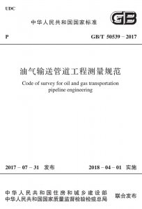
GB/T 50539-2017 油气输送管道工程测量规范 - 工标库

GB/T 50539-2017 油气输送管道工程测量规范 现行

发布日期:2017-07-31

实施日期:2018-04-01

替代以下标准: GB/T 50539-2009  

  • 标准信息
  • 中文目录
  • 英文目录
  • 公告

中文目录

  • 中华人民共和国住房和城乡建设部公告

  • 前言

  • 1 总 则

  • 2 术 语

  • 3 基本规定

    • 3.1 阶段划分和测量方法

    • 3.2 可行性研究阶段的测量工作及成果

    • 3.3 初步设计阶段的测量工作及成果

    • 3.4 施工图设计阶段的测量工作及成果

  • 4 平面控制测量

    • 4.1 一般规定

    • 4.2 GNSS静态定位测量

    • 4.3 GNSS RTK测量

    • 4.4 全站仪导线测量

  • 5 高程控制测量

    • 5.1 一般规定

    • 5.2 GNSS拟合高程测量

    • 5.3 全站仪三角高程测量

    • 5.4 GNSS RTK高程测量

  • 6 地形测量

    • 6.1 一般规定

    • 6.2 测量方法及要求

    • 6.3 水域地形测量

    • 6.4 内业成图

  • 7 线路测量

    • 7.1 一般规定

    • 7.2 线路控制测量

    • 7.3 中线测量

    • 7.4 线路带状地形图测绘

    • 7.5 纵断面测量

    • 7.6 横断面测量

    • 7.7 曲线测设

    • 7.8 线路配套工程测量

  • 8 穿(跨)越测量

    • 8.1 一般规定

    • 8.2 控制测量

    • 8.3 地形测量

    • 8.4 纵断面测量

  • 9 隧道测量

    • 9.1 控制测量

    • 9.2 地形测量

    • 9.3 纵断面测量

  • 10 站址测量

  • 11 卫星遥感测量

    • 11.1 一般规定

    • 11.2 正射纠正与镶嵌

    • 11.3 正射影像图精度

  • 12 航空摄影测量

    • 12.1 一般规定

    • 12.2 航空摄影

    • 12.3 线路控制测量

    • 12.4 像片控制测量

    • 12.5 影像调绘

    • 12.6 航空摄影测量内业

  • 本规范用词说明

  • 引用标准名录

英文目录

  • 1 General provisions

  • 2 Terms

  • 3 Basic requirements

    • 3.1 Work phases and survey methods

    • 3.2 Survey work and results of feasibility design phase

    • 3.3 Survey work and results of preliminary design phase

    • 3.4 Survey work and results of construction drawing design phase

  • 4 Horizontal control survey

    • 4.1 General requirements

    • 4.4 Traverse survey

  • 5 Vertical control survey

    • 5.1 General requirements

    • 5.3 Trigonometric leveling

  • 6 Topographic survey

    • 6.1 General requirements

    • 6.2 Survey methods and requirements

    • 6.3 Water area topographic survey

    • 6.4 Office mapping

  • 7 Route survey

    • 7.1 General requirements

    • 7.2 Rout control survey

    • 7.3 Center line survey

    • 7.4 Surveying and mapping of route strip topographic map

    • 7.5 Profile survey

    • 7.6 Cross-section survey

    • 7.7 Curve ranging

    • 7.8 Supporting projects survey

  • 8 Crossing survey

    • 8.1 General requirements

    • 8.2 Control survey

    • 8.3 Topographic survey

    • 8.4 Profile survey

  • 9 Tunnel survey

    • 9.1 Control survey

    • 9.2 Topographic survey

    • 9.3 Profile survey

  • 10 Site survey

  • 11 Remote sensing

    • 11.1 General requirements

    • 11.2 Image ortho-rectification and mosaic

    • 11.3 Accuracy of the orthophoto map

  • 12 Aerophotogrammetry

    • 12.1 General requirements

    • 12.2 Requirements for aerial photography

    • 12.3 Route control survey

    • 12.4 Photo-control points survey

    • 12.5 Classification survey

    • 12.6 Photogrammetric office work

  • Explanation of wording in this code

  • List of quoted standards

中华人民共和国住房和城乡建设部公告

4-41-10
第1635号
住房城乡建设部关于发布国家标准《油气输送管道工程测量规范》的公告
现批准《油气输送管道工程测量规范》为国家标准,编号为GB/T 50539—2017,自2018年4月1日起实施。原国家标准《油气输送管道工程测量规范》GB/T 50539—2009同时废止。
本规范在住房城乡建设部门户网站(www.mohurd.gov.cn)公开,并由我部标准定额研究所组织中国计划出版社出版发行。
中华人民共和国住房和城乡建设部
2017年7月31日

本书术语

术语 英文名称
全球导航卫星系统 global navigation satellite system(GNSS)
GNSS静态定位 GNSS static positioning
GNSS实时动态相对定位 GNSS real time kinematic relative positioning(GNSS RTK)
2″级仪器 2″class instrument
10mm级仪器 10mm class instrument
GNSS拟合高程 GNSS fitting height
GNSS RTK高程  GNSS RTK height
数字地形图 digital topographic map
中线 center line
线路带状地形图 route strip topographic map

首页 |关于我们 |联系我们 |帮助中心

主办:中国发展改革出版社 版权所有 侵权必究 合作共建单位:中国工程建设标准化协会 京ICP备05021380号-5 ICP 许可证编号 : 京B2-20262562
新建收藏夹

选择收藏夹

收藏夹名称