点击右上角 ··· 选择
【发送给好友】或【分享到朋友圈】
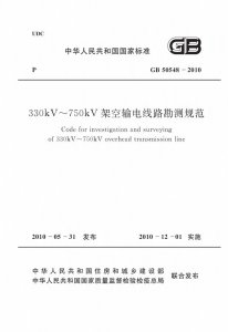
GB 50548-2010 330kV~750kV架空输电线路勘测规范 - 工标库

GB 50548-2010 330kV~750kV架空输电线路勘测规范 废止

发布日期:2010-05-31

实施日期:2010-12-01

被以下标准替代: GB/T 50548-2018  

废止日期:2019-03-01

  • 标准信息
  • 中文目录
  • 英文目录
  • 公告

中文目录

  • 中华人民共和国住房和城乡建设部公告

  • 前言

  • 1 总则

  • 2 术语和符号

    • 2.1 术语

    • 2.2 符号

  • 3 基本规定

    • 3.1 测量

    • 3.2 岩土工程勘察

    • 3.3 工程水文勘测

    • 3.4 工程气象勘测

  • 4 可行性研究阶段测量

    • 4.1 一般规定

    • 4.2 室内工作

    • 4.3 现场工作

    • 4.4 提交的成品资料

  • 5 初步设计阶段测量

    • 5.1 一般规定

    • 5.2 室内选择路径方案

    • 5.3 现场选择路径方案

    • 5.4 航空摄影

    • 5.5 GPS主控网的建立及GPS航测外控

    • 5.6 像片调绘

    • 5.7 航片扫描

    • 5.8 空中三角测量

    • 5.9 建立路径三维数字模型

    • 5.10 三维数字模型路径优化

    • 5.11 提交的成品资料

  • 6 施工图设计阶段测量

    • 6.1 一般规定

    • 6.2 选线测量

    • 6.3 定线测量

    • 6.4 桩间距离和高差测量

    • 6.5 平面及高程联系测量

    • 6.6 平面及断面测量

    • 6.7 交叉跨越测量

    • 6.8 定位与检验测量

    • 6.9 塔基断面及塔位地形测量

    • 6.10 房屋分布图测量

    • 6.11 塔位坐标测量

    • 6.12 林木分布测量

    • 6.13 接地极极址测量

    • 6.14 提交的成品资料

  • 7 可行性研究阶段岩土工程勘察

  • 8 初步设计阶段岩土工程勘察

  • 9 施工图设计阶段岩土工程勘察

    • 9.1 一般规定

    • 9.2 平原与河谷地区勘察

    • 9.3 山地丘陵区勘察

  • 10 岩土工程勘察方法

    • 10.1 工程地质调查

    • 10.2 遥感解译

    • 10.3 工程物探

    • 10.4 勘探与测试

  • 11 特殊岩土分布区岩土工程勘察

    • 11.1 湿陷性黄土

    • 11.2 冻土

    • 11.3 软土

    • 11.4 膨胀岩土

    • 11.5 红黏土

    • 11.6 填土

    • 11.7 风化岩与残积土

    • 11.8 盐渍土

    • 11.9 混合土

  • 12 特殊地质条件岩土工程勘察

    • 12.1 岩溶与洞穴

    • 12.2 滑坡

    • 12.3 崩塌与倒石堆

    • 12.4 冲沟

    • 12.5 泥石流

    • 12.6 地震液化

    • 12.7 采空区

  • 13 原体试验

    • 13.1 一般规定

    • 13.2 基桩原体试验

    • 13.3 锚杆基础和原状土基础试验

    • 13.4 原体试验成果编制

  • 14 基坑检验

  • 15 岩土工程勘察成果

    • 15.1 一般规定

    • 15.2 可行性研究阶段

    • 15.3 初步设计阶段

    • 15.4 施工图设计阶段

  • 16 可行性研究阶段工程水文勘测

    • 16.1 一般规定

    • 16.2 勘测内容深度与技术要求

    • 16.3 勘测成果

  • 17 初步设计阶段工程水文勘测

    • 17.1 一般规定

    • 17.2 勘测内容深度与技术要求

    • 17.3 勘测成果

  • 18 施工图设计阶段工程水文勘测

    • 18.1 一般规定

    • 18.2 勘测内容深度与技术要求

    • 18.3 勘测成果

  • 19 水文查勘

    • 19.1 一般规定

    • 19.2 人类活动影响调查

    • 19.3 洪涝调查

    • 19.4 河床演变调查

    • 19.5 冰情及河流漂浮物调查

    • 19.6 特殊地区水文调查

    • 19.7 水文测验

  • 20 水文分析计算

    • 20.1 一般规定

    • 20.2 天然河流设计洪水

    • 20.3 水库上下游设计洪水

    • 20.4 溃堤溃坝洪水

    • 20.5 冰情洪水

    • 20.6 特殊地区洪水

    • 20.7 设计洪水位

    • 20.8 设计流速

    • 20.9 滨海、河口水文分析计算

  • 21 河(海)床演变分析

    • 21.1 一般规定

    • 21.2 河床演变分析

    • 21.3 海床演变分析

  • 22 可行性研究阶段工程气象勘测

    • 22.1 一般规定

    • 22.2 勘测内容深度与技术要求

    • 22.3 勘测成果

  • 23 初步设计阶段工程气象勘测

    • 23.1 一般规定

    • 23.2 勘测内容深度与技术要求

    • 23.3 勘测成果

  • 24 施工图设计阶段工程气象勘测

    • 24.1 一般规定

    • 24.2 勘测内容深度与技术要求

    • 24.3 勘测成果

  • 25 气象调查

    • 25.1 一般规定

    • 25.2 大风调查

    • 25.3 覆冰调查

    • 25.4 主导风向调查

    • 25.5 专用气象站与观测

  • 26 气象分析计算

  • 附录A 拥挤地段平面图样图

  • 附录B 通信线危险影响相对位置图

  • 附录C 变电站或发电厂进出线平面图样图

  • 附录D 测量标桩规格及埋设尺寸

  • 附录E 平行接近线路相对位置平面图样图

  • 附录F 输电线路平断面图

  • 附录G 平面图、断面图符号表

  • 附录H 交叉跨越断面分图样图

  • 附录J 交叉跨越平面分图样图

  • 附录K 塔基断面图样图

  • 附录L 塔位地形图样图

  • 附录M 房屋分布图样图

  • 附录N 塔基水文条件一览表

  • 附录P 设计风速计算

  • 附录Q 设计冰厚计算

  • 本规范用词说明

  • 引用标准名录

英文目录

  • 1 General provisions

  • 2 Term and symbols

    • 2.1 Terms

    • 2.2 Symbols

  • 3 Basical requirements

    • 3.1 survey

    • 3.2 geotechnical investigation

    • 3.3 engineering hydrological investigation and surveying

    • 3.4 engineering meteorological investigation and surveying

  • 4 Survey of feasibility study stage

    • 4.1 General requirements

    • 4.2 Office work

    • 4.3 Field work

    • 4.4 Finished product submitted

  • 5 Survey of preliminary design stage

    • 5.1 General requirements

    • 5.2 Route selection plan indoor

    • 5.3 Route selection plan outdoor

    • 5.4 Aerial photography

    • 5.5 Establishment of GPS control network and GPS field control point

    • 5.6 Photo annotation

    • 5.7 Aerial photo scanning

    • 5.8 Aerotriangulation

    • 5.9 Establishment of 3D digtal route model

    • 5.10 Optimization of 3-D digtal route model

    • 5.11 Finished product submitted

  • 6 Survey of working drawing design stage

    • 6.1 General requirements

    • 6.2 Route selection survey

    • 6.3 Straight line location survey

    • 6.4 Survey of distance between two stakes and difference of elevation

    • 6.5 Plane and elevation connection survey

    • 6.6 Plane and section survey

    • 6.7 Cross survey

    • 6.8 Positioning and test survey

    • 6.9 Section survey of tower foundation and topographic survey of tower position

    • 6.10 House distribution survey

    • 6.11 Tower coordinate survey

    • 6.12 Forest distribution survey

    • 6.13 Grounding electrode positioning survey

    • 6.14 Finished product submitted

  • 7 Geotechnical investigation of feasibility study stage

  • 8 Geotechnical investigation of preliminary design stage

  • 9 Geotechnical investigation of working drawing design stage

    • 9.1 General requirements

    • 9.2 Investigation for plain and river valley

    • 9.3 Investigation for mountain and hill

  • 10 Method of geotechnical investigation

    • 10.1 Engineering Geological Survey

    • 10.2 Remote sensing

    • 10.3 Geophysical exploration

    • 10.4 Exploration and testing

  • 11 Geotechnical investigation for special lithology

    • 11.1 Collapsible loess

    • 11.2 Frozen soil

    • 11.3 Soft soil

    • 11.4 Swelling soil and rock

    • 11.5 Red clay

    • 11.6 Filled ground

    • 11.7 Weathered rock and residual soil

    • 11.8 Saline soil

    • 11.9 Mixed soil

  • 12 Geotechnical investigation for special geologic condition

    • 12.1 Karst and cave

    • 12.2 Landslipe

    • 12.3 Avalanche and collapse heap

    • 12.4 Gully

    • 12.5 Debris flow

    • 12.6 Seismic liquefaction

    • 12.7 Mined out space

  • 13 Prototype test

    • 13.1 General requirements

    • 13.2 Prototype test for pile foundation

    • 13.3 Anchored foundation and shallow foundation test

    • 13.4 Result reporting for prototype test

  • 14 Foundaion pit proving

  • 15 Result of geotechnical investigation

    • 15.1 General requirements

    • 15.2 Feasibility study stage

    • 15.3 Preliminary design stage

    • 15.4 Working drawing design stage

  • 16 Engineering hydrological investigation and surveying of feasibility study stage

    • 16.1 General requirements

    • 16.2 Contents and technical requirement

    • 16.3 Outcome

  • 17 Engineering hydrological investigation and surveying of preliminary design stage

    • 17.1 General requirements

    • 17.2 Contents and technical requirement

    • 17.3 Outcome

  • 18 Engineering hydrological investigation and surveying of working drawing design stage

    • 18.1 General requirements

    • 18.2 Contents and technical requirement

    • 18.3 Outcome

  • 19 Hydrological investigation and surveying

    • 19.1 General requirements

    • 19.2 Impact of human activity

    • 19.3 Flood and waterlogging

    • 19.4 Riverbed evolution

    • 19.5 Ice and river float

    • 19.6 Specific areas

    • 19.7 Hydrological survey

  • 20 Hydrological analysis and calculation

    • 20.1 General requirements

    • 20.2 Natural river design flood

    • 20.3 Design flood about the upper stream and downstream of the reservoir

    • 20.4 The dike-breach and dam-break design flood

    • 20.5 Ice flood

    • 20.6 Special area design flood

    • 20.7 The design flood stage

    • 20.8 The design flow rate

    • 20.9 The hydrological analysis about the coastal and river mouth area

  • 21 The evolution analysis of the river(sea)bed

    • 21.1 General requirements

    • 21.2 Analysis of the evolution of the river bed

    • 21.3 Analysis of the evolution of the seabed

  • 22 Engineering meteorological investigation and surveying of feasibility study stage

    • 22.1 General requirements

    • 22.2 Content and technical requirement

    • 22.3 Outcome

  • 23 Engineering meteorological investigation and surveying of preliminary design stage

    • 23.1 General requirements

    • 23.2 Content and technical requirement

    • 23.3 Outcome

  • 24 Engineering meteorological investigation and surveying of working drawing design stage

    • 24.1 General requirements

    • 24.2 content and technical requirement

    • 24.3 outcome

  • 25 Meteorology survey

    • 25.1 General requirements

    • 25.2 Strong wind

    • 25.3 Wire ice covering

    • 25.4 Predominant wind direction

    • 25.5 Meteorology special-purpose station and observation

  • 26 Meteorological analysis and calculation

  • Appendix A Planimetic map in crowded area

  • Appendix C Plan legend for substation or power plant lines in and out

  • Appendix D Survey stake standard and embedding size

  • Appendix E Relative position plan samples of parallel proximity line

  • Appendix F Plan and section samples of transmission line

  • Appendix G Symbol list of planemetric and section plan

  • Appendix H Intersection and cross section plan

  • Appendix K Tower foundation section plan

  • Appendix L Tower position topographic map

  • Appendix M House distribution map

  • Appendix P The calculation about the design wind speed

  • Appendix Q The calculation about the design wire ice covering thickness

  • Explanation of wording in this code

  • List of quoted standards

中华人民共和国住房和城乡建设部公告

4-4 0-0 0
第 633 号
关于发布国家标准《330kV~750kV架空输电线路勘测规范》的公告
现批准《330kV~750kV架空输电线路勘测规范》为国家标准,编号为GB 50548-2010,自2010年12月1日起实施。其中,第1.0.43.3.23.4.612.1.112.2.112.5.1条为强制性条文,必须严格执行。
本规范由我部标准定额研究所组织中国计划出版社出版发行。
中华人民共和国住房和城乡建设部
二〇一〇年五月三十一日

本书术语

术语 英文名称
大跨越 large crossing
定线测量 straight line location survey
直线性 linearity
直线桩 the stake of straight line
方向桩 directional stake
桩间距离 distance between two stakes
桩间高差 difference of elevation between two stakes
中心断面 central section
边线 side line
风偏点 wind slanting point

首页 |关于我们 |联系我们 |帮助中心

主办:中国计划出版社 版权所有 侵权必究 合作共建单位:中国工程建设标准化协会 京ICP备05021380号-5
新建收藏夹

选择收藏夹

收藏夹名称