首页 >标准规范

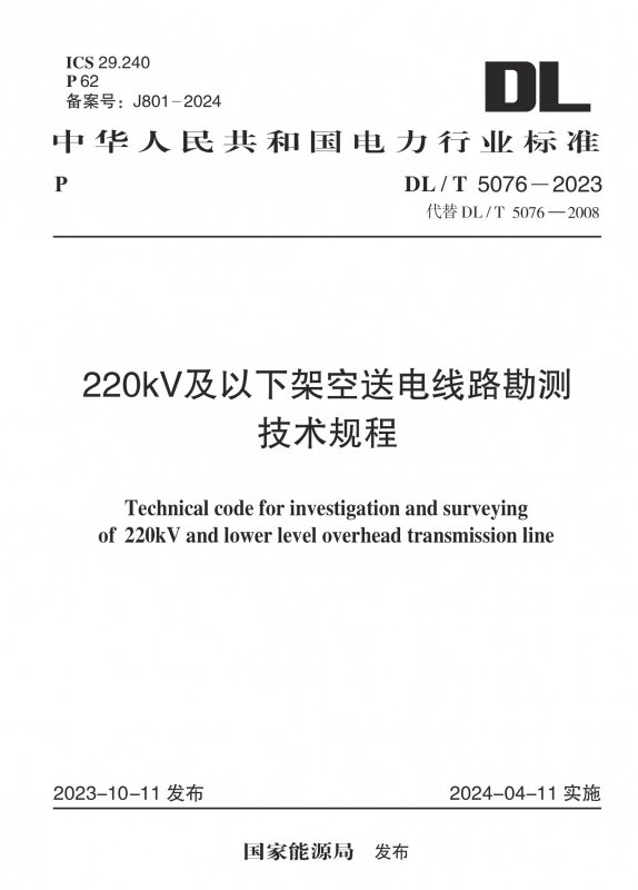
220kV及以下架空送电线路勘测技术规程

Technical code for investigation and surveying of 220kV and lower level overhead transmission line

会员免费阅读,去 购买

  • 标准信息
  • 中文目录
  • 英文目录
  • 公告
收起

标准信息

  • 【主编部门】
    电力规划设计总院
  • 【批准部门】

    国家能源局

  • 【发布单位】

    国家能源局

  • 【主编单位】

    山东电力工程咨询院有限公司;中国电力工程顾问集团东北电力设计院有限公司;中国能源建设集团山西省电力勘测设计院有限公司

  • 【参编单位】

    四川电力设计咨询有限责任公司;中国能源建设集团黑龙江省电力设计院有限公司;中国电建集团河南省电力勘测设计院有限公司;中国能源建设集团湖南省电力设计院有限公司

  • 【主要起草人】

    常增亮;娄俊庆;王起峰;朱亚光;(以下按姓氏笔画先后排序);于兴杰;马惠群;王日;卢晓东;田武成;孙宝中;李关强;杨煜;吴列;张文兵;张帅领;张江华;陈铭;陈振华;范沛军;欧子春;周政;庞大鹏;胡守超;徐廷鹏;高首都;郭军辉;曾德培;薛飞;薛远峰

  • 【主要审查人】

    邓南文;朱宏波;姚鹏;李建国;张奇;李卫军;毛克;刘礼领;刘志伟;马海毅;刘珍岩;潘晓春;胡昌盛;王国羽;曹双和

收起

中文目录

  • 国家能源局公告

  • 前言

  • 1 总 则

  • 2 术语和缩略语

    • 2.1 术 语

    • 2.2 缩略语

  • 3 基本规定

    • 3.1 测 量

    • 3.2 岩土工程

    • 3.3 水文气象

  • 4 设计阶段测量

    • 4.1 可行性研究阶段测量

    • 4.2 初步设计阶段测量

    • 4.3 施工图设计阶段测量

  • 5 改造测量

    • 5.1 一般规定

    • 5.2 交叉跨越改造测量

    • 5.3 风灾改造测量

    • 5.4 冰灾改造测量

    • 5.5 导线温升增容改造测量

  • 6 专项测量

    • 6.1 塔位地形图

    • 6.2 地下管线探测

    • 6.3 土石方测量

    • 6.4 林木分布调查测量

    • 6.5 水文测量

    • 6.6 运行维护测量

    • 6.7 安全监测

    • 6.8 林木勘查

  • 7 设计阶段岩土工程勘测

    • 7.1 可行性研究阶段岩土工程勘测

    • 7.2 初步设计阶段岩土工程勘测

    • 7.3 施工图设计阶段岩土工程勘测

  • 8 岩土工程勘测方法

    • 8.1 遥感解译

    • 8.2 工程地质调查

    • 8.3 勘探与测试

    • 8.4 工程物探

  • 9 复杂地质条件岩土工程勘测

    • 9.1 特殊岩土勘测

    • 9.2 特殊地质条件勘测

  • 10 设计阶段工程水文勘测

    • 10.1 可行性研究阶段工程水文勘测

    • 10.2 初步设计阶段工程水文勘测

    • 10.3 施工图设计阶段工程水文勘测

  • 11 水文查勘

    • 11.1 一般规定

    • 11.2 人类活动影响调查

    • 11.3 洪涝调查

    • 11.4 河床与海床演变调查

    • 11.5 冰情与漂浮物调查

    • 11.6 特殊地区水文调查

  • 12 设计洪水分析计算

    • 12.1 一般规定

    • 12.2 天然河流设计洪水

    • 12.3 水库上下游设计洪水

    • 12.4 冰情洪水

    • 12.5 滨海与河口水文

    • 12.6 特殊地区洪水

    • 12.7 设计洪水位与设计流速

  • 13 河床与海床演变分析

    • 13.1 一般规定

    • 13.2 河床演变

    • 13.3 海床演变

    • 13.4 基础冲刷

  • 14 设计阶段工程气象勘测

    • 14.1 可行性研究阶段工程气象勘测

    • 14.2 初步设计阶段工程气象勘测

    • 14.3 施工图设计阶段工程气象勘测

  • 15 气象查勘

    • 15.1 一般规定

    • 15.2 大风调查

    • 15.3 覆冰调查

  • 16 气象分析计算

    • 16.1 一般规定

    • 16.2 设计风速

    • 16.3 设计冰厚

    • 16.4 特征气温与同时气象条件

  • 附录A 拥挤地段平面图样图

  • 附录B 交叉跨越分图样图

  • 附录C 平行线路影响相对位置图样图

  • 附录D 变电站进出线平面图样图

  • 附录E 送电线路平断面图样图

  • 附录F 平面图、断面图符号表

  • 附录G 塔基断面图样图

  • 附录H 房屋分布图样图

  • 附录J 塔位地形图样图

  • 附录K 土(岩)的承载力特征值

  • 附录L 边坡容许坡度值

  • 附录M 塔位水文条件和气象条件一览表

  • 本标准用词说明

  • 引用标准名录

  • 编制说明

收起

英文目录

  • 1 General provisions

  • 2 Terms and abbreviations

    • 2.1 Terms

    • 2.2 Abbreviations

  • 3 Basic requirements

    • 3.1 Survey

    • 3.2 Geotechnical investigation

    • 3.3 Engineering hydrological and meteorological investigation and surveying

  • 4 Survey of different design stage

    • 4.1 Survey of feasibility study stage

    • 4.2 Survey of preliminary design stage

    • 4.3 Survey of working drawing design stage

  • 5 Electric power line reconstruction survey

    • 5.1 General requirements

    • 5.2 Cross reconstruction survey

    • 5.3 Wind disaster reconstruction survey

    • 5.4 Ice disaster reconstruction survey

    • 5.5 Temperature rise increase capacity reconstruction survey

  • 6 Special survey

    • 6.1 Topographic survey of tower foundation

    • 6.2 Underground pipeline detection and survey

    • 6.3 Earthwork volume survey

    • 6.4 Forest distribution survey

    • 6.5 Hydrological survey

    • 6.6 Maintenance survey for operation phase

    • 6.7 Safety monitoring

    • 6.8 Foresty prospect

  • 7 Geotechnical investigation of design stage

    • 7.1 Geotechnical investigation of feasibility study stage

    • 7.2 Geotechnical investigation of preliminary design stage

    • 7.3 Geotechnical investigation of detail design stage

  • 8 Method of geotechnical investigation

    • 8.1 Remote sensing interpretation

    • 8.2 Engineering geological survey

    • 8.3 Exploration and testing

    • 8.4 Geophysical exploration

  • 9 Geotechnical investigation under complicated geologic conditions

    • 9.1 Geotechnical investigation for special stratums

    • 9.2 Geotechnical investigation under special geologic conditions

  • 10 Engineering hydrological investigation and survey of different stage

    • 10.1 Engineering hydrological investigation and survey of feasibility study stage

    • 10.2 Engineering hydrological investigation and survey of preliminary design stage

    • 10.3 Engineering hydrological investigation and survey of working drawing design stage

  • 11 Hydrology investigation and survey

    • 11.1 General requirements

    • 11.2 Impact of human activity

    • 11.3 Flood and waterlogging

    • 11.4 Riverbedand sea bed evolution

    • 11.5 Ice and float

    • 11.6 Specific areas

  • 12 Hydrological analysis and calculation

    • 12.1 General requirements

    • 12.2 Natural river design flood

    • 12.3 Design flood about the upperstream and downstream of the reservoir

    • 12.4 Ice flood

    • 12.5 Hydrological analysis ahout coastal and river mouth area

    • 12.6 Special area design flood

    • 12.7 Design flood stage and flow rate

  • 13 Evolution analysis of river and sea bed

    • 13.1 General requirements

    • 13.2 Analysis of river bed evolution

    • 13.3 Analysis of sea bed evolution

    • 13.4 Scour analysis calculation

  • 14 Engineering meteorological investigation and survey of different stage

    • 14.1 Engineering meteorological investigation and survey of feasibility study stage

    • 14.2 Engineering meteorological investigation and survey of preliminary design stage

    • 14.3 Engineering meteorological investigation and survey of working drawing design stage

  • 15 Meteorology survey

    • 15.1 General requirements

    • 15.2 Strong wind

    • 15.3 Wire ice covering

  • 16 Meteorological analysis and calculation

    • 16.1 General requirements

    • 16.2 Design wind speed

    • 16.3 Design wire ice covering

    • 16.4 Characteristic temperature and meteorological condition

  • Appendix A Planimetic map in crowded area

  • Appendix B Intersection and crossing plan

  • Appendix C Relative position plan of parallel proximity line

  • Appendix D Incomeing and outgoing lines plan of substation

  • Appendix E Plan and section samples of transmission line

  • Appendix F Cartographic symblol list of plan and section map

  • Appendix G Tower foundation section plan

  • Appendix H House distribution map

  • Appendix J Tower position topographic map

  • Appendix K Characteristic value of bearing capacity of soil(rock)layers

  • Appendix L Allowable slope ratio

  • Appendix M Schedule of tower hydrological and meteorological condition

  • Explanation wording in this standard

  • List of quoted standards

收起

公告

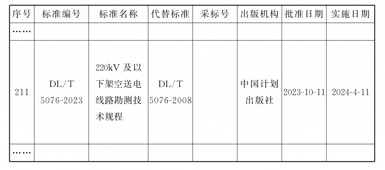
国家能源局公告

3-30-01
2023年 第5号
根据《中华人民共和国标准化法》《能源标准化管理办法》,国家能源局批准《电动汽车充放电双向互动 第1部分:总则》等261项能源行业标准(附件1)、《Specification for geotechnical tests of offshore wind power projects》等42项能源行业标准外文版(附件2),现予以发布。
附件:1.行业标准目录
2.行业标准外文版目录
国家能源局
2023年10月11日
附件1:
行业标准目录(节选)
收起

本书术语

术语 英文名称 术语 英文名称
基础控制测量 basic control survey 落实路径测量 route loacation survey
桩间距离 distance between two stakes 中心断面 central section
边线断面 sideline section 风偏点 wind slanting point
交叉跨越点 crossed point of two lines 横断面 cross section
定位测量 location survey 档距 distance between two poles

确定

功能项目 注册用户 普通会员 高级会员/企业版
计划版标准阅读 仅限国标条文 库内全部标准 库内全部标准
标准关联查询
强制性条文聚合
标准资源对比
术语查询
知识库管理
服务资讯查看
原版标准阅读
条文说明阅读
标准文字复制(200字/次) 100次/月 不限
标准追踪
行业定制
实用表格下载(仅PC端)
电子书与视频
专家解读视频 免费视频 免费视频 全部视频